SQUAW PEAK
YAVAPAI COUNTY, ARIZONA
- OVERVIEW
- HISTORICAL
- GEOLOGIC SETTING
- PREVIOUS EXPLORATION
- PLANNED EXPLORATION
The Squaw Peak Project is an advanced exploration property hosting a porphyry copper-molybdenum+silver deposit. Based on grades seen in surface outcrop, underground workings and in drill holes, the project has the potential to host > 500 Mt grading 0.35-0.40% Cu eq. The deposit begins on the surface and its extent at depth is unconstrained by drilling. Given the volume of potential mineralization, its location in a Tier One copper province, Squaw Peak represents an outstanding growth opportunity for Copper Resource Group.
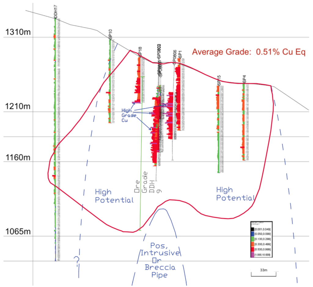
The Project covers approximately 350 hectares in northeast Yavapai County, about 55 kilometers east of Prescott, Arizona. Previous exploration by Kennecott, Callahan, Phillips Petroleum, Essex, American Copper Company and Regal Resources included surface and underground mapping, soil and rock sampling, aeromagnetic surveys, and drilling 37 core holes and 25 churn holes from the surface with an additional 17 underground core holes totaling 11,328 meters. In addition, four production adits were driven during World War II exploiting high grade copper and molybdenum hosted by a breccia pipe or brecciated quartz vein.
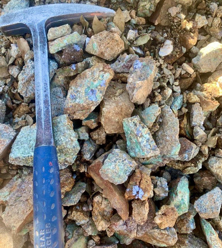
The geologic characteristics of the Squaw Peak deposit are typical of many other large Laramide age porphyry copper deposits in Arizona. Key geological features of Squaw Peak are:
- concentric zonal patterns of alteration ranging from an inner potassic zone, a quartz- sericite-pyrite (phyllic) zone and an outer propylitic zone around a quartz monzonite porphyry plug or stock emplaced along a structural zone,
- Cu-Mo-Ag mineralization appears to be genetically associated with the epizonal quartz monzonite porphyry intrusion,
- Cu and Mo sulfides dominate the primary economic mineral suite,
- sulfides typically have a homogeneous distribution as disseminations or stockwork/crackle fractures/veinlets, mostly in the Precambrian granodiorite that has been intruded by a Laramide quartz monzonite intrusion,
- mineralization has gradational distribution, especially to the north and west,
- local shattered or brecciated zones host spotty mineralization with a direct relationship between degree of fracturing and the intensity of sulfide.
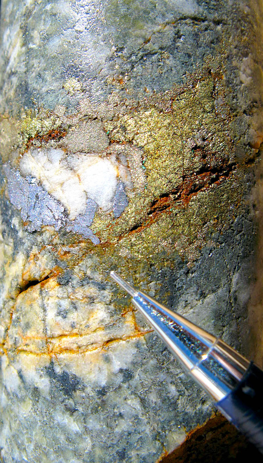
Copper-moly mineralization crops out over a large area at Squaw Peak and has been traced in drill holes to approximately 300 meters below the surface. Copper grade distribution is very regular in primary mineralization with some copper enrichment near the surface. Many drill holes bottom in good grade copper mineralization emphasizing the ability to rapidly expand resources with additional drilling. Various non-compliant resource estimates have been made for Squaw Peak, the most recent reported approximately 200 Mt of 0.30% Cu Eq. Historic underground sampling and drilling at the Squaw Peak Project demonstrating excellent continuity of copper, silver, and molybdenum mineralization.
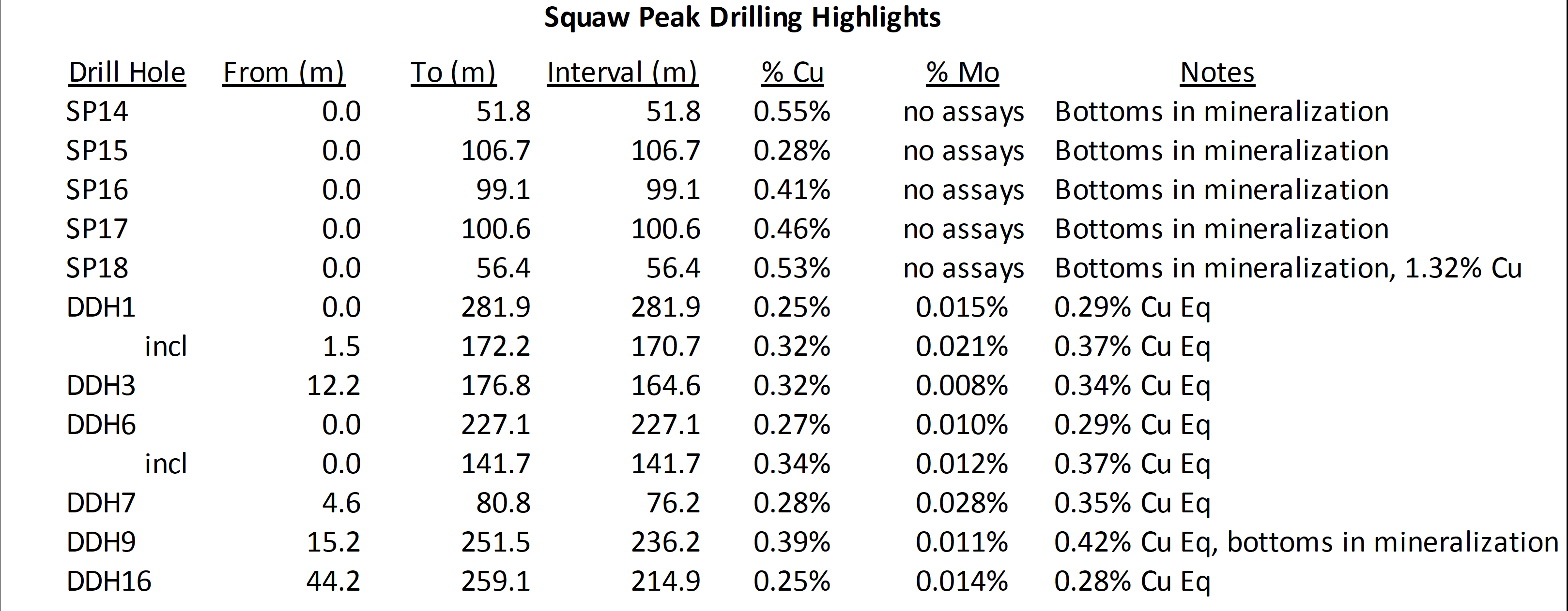
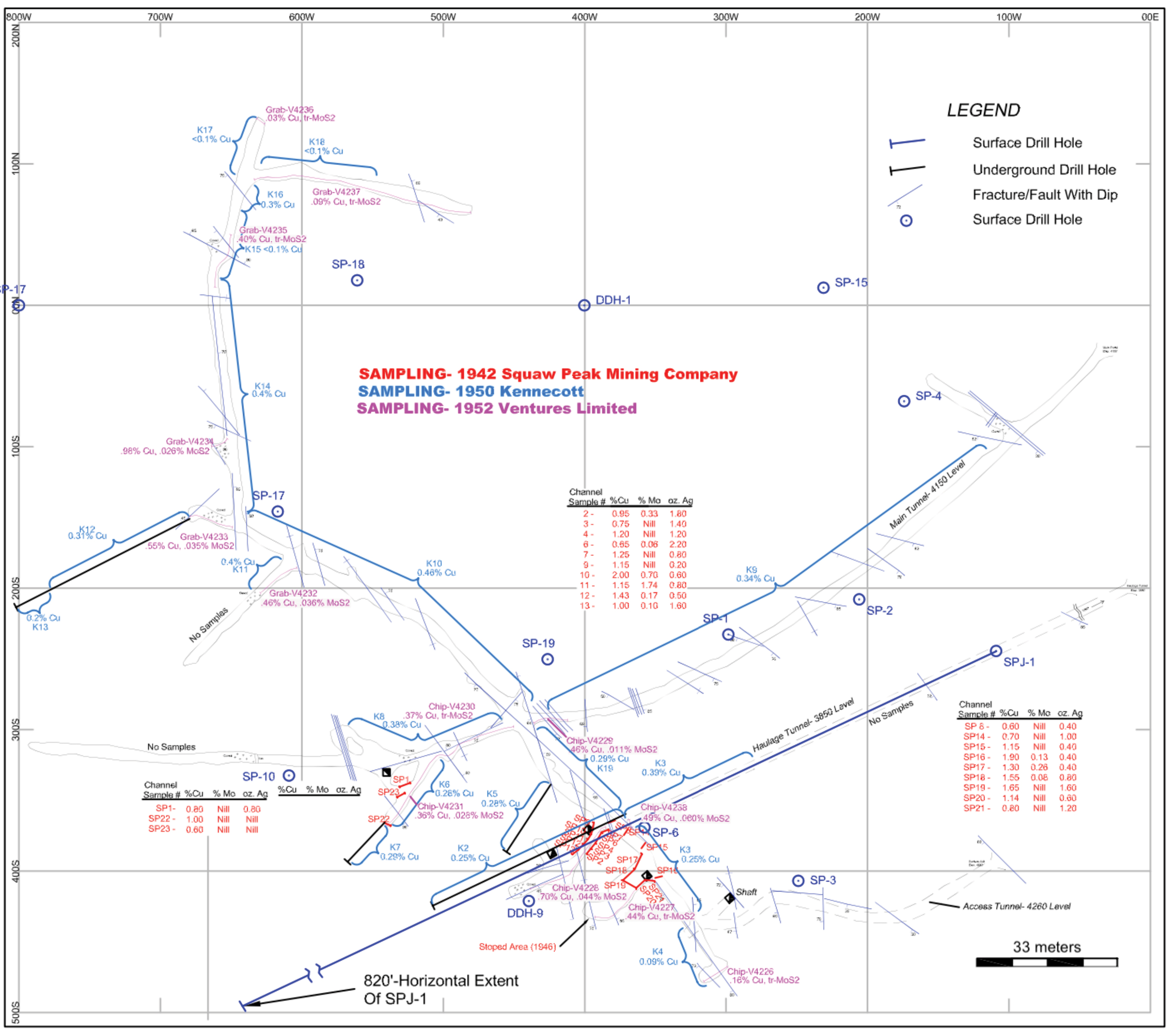
Compilation of existing surface and underground mapping is the first phase of exploration at Squaw Peak. Additional ground mapping of alteration assemblages and geophysics. An initial 5000 meter reverse-circulation drill program is contemplated for Squaw Peak targeting extensions to known copper-molybdenum resources.
